Evan Moor Educational Publishers
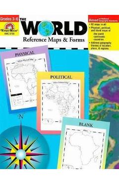
The World Reference & Map Forms: Grades 3-6 - Evan-moor Educational Publishers
Cod EAN 9781557999542
Preț
111,55 lei
123,94 lei
−10%
Fără reducere reală
Cel mai mic preț din cele 9 zile dinainte de 22 octombrie 2026 a fost 99,15 lei, mai mic decât acum. Reducerea de −10% e calculată față de prețul vechi afișat de magazin (123,94 lei).
Peste prețul mediu din ultimele 28 de zile
Media: 111 lei. Cel mai mic preț a fost 99,15 lei, ultima dată pe 21 octombrie 2026; acum e cu 13% mai mult. Vezi istoricul
la Libris
- Transport gratuit peste 135 lei
- Cupon de 10% la abonarea la newsletter
- Retur extins la 30 de zile
În stoc la Libris Prețuri actualizate la 22 octombrie 2026, 16:11
Oferta disponibilă
Prețurile și disponibilitatea sunt preluate automat de la magazine și se pot schimba. Când cumperi printr-un link de pe site, putem primi un comision de la magazin, fără niciun cost în plus pentru tine. Cum funcționează
-
 The World Reference & Map Forms: Grades 3-6 - Evan-moor Educational Publishers
În stoc
111,55 lei
Cel mai mic preț înainte
123,94 lei
Istoricul prețului
| Perioada | Cel mai mic | Cel mai mare | Prețul mediu | Scăderi |
|---|---|---|---|---|
| De când îl urmărim (28 de zile) | 99,15 lei | 111,55 lei | 111 lei | 1 |
Vezi schimbările de preț
| Din data | Cel mai mic preț |
|---|---|
| 22 octombrie 2026 | 111,55 lei |
| 20 octombrie 2026 | 99,15 lei |
| 13 octombrie 2026 | 111,55 lei |
Descriere
\nThe World--Reference Maps & Forms contains 92 maps, evaluation forms, a crossword puzzle, a word search, and an answer key. The first section, The World, includes: - an introduction of general facts about the world - a list of 192 countries in the world - a reference political map of the continents - a blank world map - Robinson and Mercator projection maps - globes, showing hemispheres, parallels, and meridians - maps of oceans, rivers, mountain ranges, and deserts The second section, The Continents, includes: North America: - an introduction, listing the countries, area, population, elevations, and fun facts about the continent - reference political and physical maps of North America, Canada, the United States, and Mexico - blank outline maps of North America, Canada, the United States, and Mexico--shape, political, and physical - study maps of each region of the United States and Mexico and the provinces and territories of Canada - a reference map of six regions of the United States - study maps of Central America, the Greater Antilles, and a reference map of the Lesser Antilles Africa, Europe, Asia, and Australia - an introduction, listing the countries, area, population, elevations, and fun facts about the continent - a reference political and a physical map of the continent (a political map of Oceania is included with Australia) - blank outline maps of the continent--shape, political, and physical - study maps of regions of the continent Antarctica and the Arctic Region - an introduction, listing the area, elevations, and fun facts about the continent - reference polar projection maps of Antarctica and the Arctic Region - a reference map of the scientific stations in Antarctica - blank outline projection maps of Antarctica and the Arctic Region
Descrierea este preluată de la magazin.