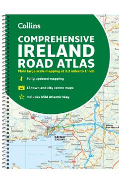
Comprehensive Road Atlas Ireland - Collins Maps
Cod EAN 9780008412814
Preț
64,74 lei
71,93 lei
−10%
Fără reducere reală
Cel mai mic preț din cele 9 zile dinainte de 22 octombrie 2026 a fost 57,54 lei, mai mic decât acum. Reducerea de −10% e calculată față de prețul vechi afișat de magazin (71,93 lei).
Peste prețul mediu din ultimele 29 de zile
Media: 64,24 lei. Cel mai mic preț a fost 57,54 lei, ultima dată pe 21 octombrie 2026; acum e cu 13% mai mult. Vezi istoricul
la Libris
- Transport gratuit peste 135 lei
- Cupon de 10% la abonarea la newsletter
- Retur extins la 30 de zile
În stoc la Libris Prețuri actualizate la 4 noiembrie 2026, 22:00
Oferta disponibilă
Prețurile și disponibilitatea sunt preluate automat de la magazine și se pot schimba. Când cumperi printr-un link de pe site, putem primi un comision de la magazin, fără niciun cost în plus pentru tine. Cum funcționează
-
 Comprehensive Road Atlas Ireland - Collins Maps
În stoc
64,74 lei
Cel mai mic preț înainte
71,93 lei
Istoricul prețului
| Perioada | Cel mai mic | Cel mai mare | Prețul mediu | Scăderi |
|---|---|---|---|---|
| De când îl urmărim (29 de zile) | 57,54 lei | 64,74 lei | 64,24 lei | 1 |
Vezi schimbările de preț
| Din data | Cel mai mic preț |
|---|---|
| 22 octombrie 2026 | 64,74 lei |
| 20 octombrie 2026 | 57,54 lei |
| 13 octombrie 2026 | 64,74 lei |
Descriere
A clear, detailed road atlas of Ireland in a handy A4 spiral-bound format. This comprehensive, general purpose road atlas of the whole of Ireland is ideal for both business and pleasure use. The atlas contains a range of mapping scales: \n \n- 9 miles to 1 inch route planning map \n- Main maps at 3.2 miles to 1 inch, which are ideal for navigation \n- A wide selection of detailed town center street plans \nThis edition boasts road mapping packed with detail--showing color classified road network, toll roads, land heights, the location of safety cameras, Blue Flag and Green Coast beaches, tourist information centers, and a wide range of tourist attractions. There is also comprehensive guide information for visitors to Belfast, Cork, Dublin, and Limerick. The locations of Speed Enforcement Zones, which highlight roads that have a high risk of accidents as identified by the Garda and the National Roads Authority, are included. \n There is also a wide range of fully indexed town and city center maps. These are: Bangor, Belfast, Cork, Drogheda, Dublin, Dún Laoghaire, Galway, Kilkenny, Killarney, Limerick, Lisburn, Londonderry (Derry), Newry, Newtownabbey, and Waterford.\n
Descrierea este preluată de la magazin.